Eglish Valley
9th June 2024
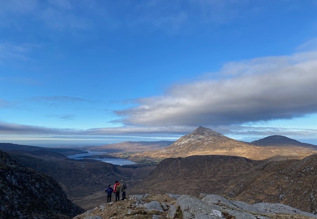
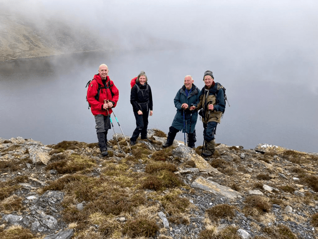
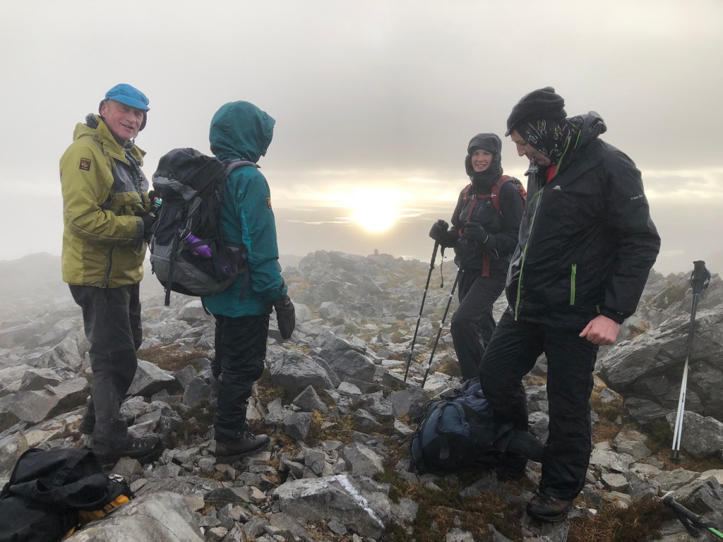
EGLISH: Wet wet wet, in the Bluestacks with NWMC. Some went for a walk, some went on the planned route around Lough Belshade, some turned back. I went around the Eglish valley to reacquaint myself with the rock climbs we did back in the 90s, and to see if they were badly overgrown. No so, as far as I could see in the gloom. 3.5 hours, and it never let up.
Alan Tees

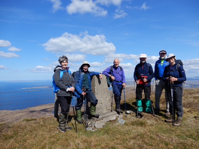
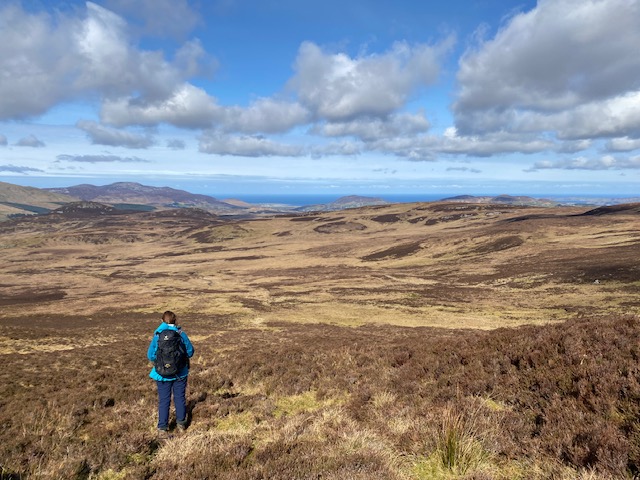
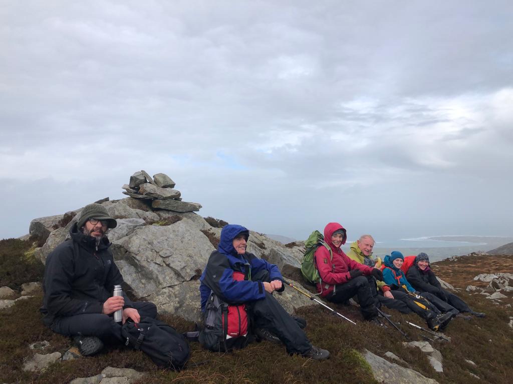
Lough Salt
19th May 2024
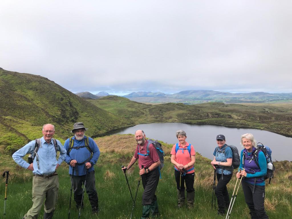
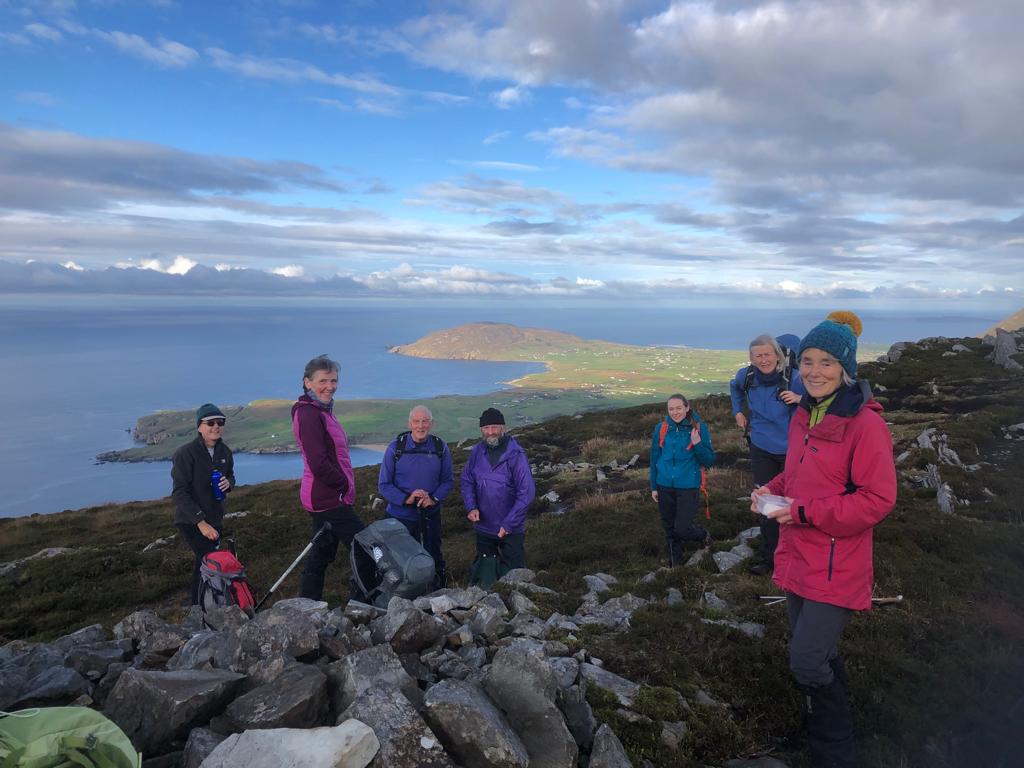
We went north east on the grassy ridge above the road from the
main carpark to allow time for the mist to clear from the Lough Salt
summits . Then up the steep NE slopes above Lough Reelan by a
vague path and made our way NE through complex small hills, loughs
and turf tracks to unnamed summit 343. Very scenic and convivial
lunch stop.
Members were shocked by the rubbish dumping beside the turf
tracks and the damage done by Quads and bikes even on high slopes.
We then turned back south and ascended the main Lough Salt
summits which were now mist free. Exceptional 360 degree
panorama –Tory,Muckish, Errigal Derryveaghs, Slievetooey , Blue
Stacks, Cuilcagh,Sperrins , Inch. All spread out like a map around us.
Members tell me it was 10.5 km and took nearly 5 hours. You could
do it faster but we took our time to enjoy the magnificent views.
This is my favourite walk in Donegal. Not that difficult but very
rewarding views in clear weather. The good humoured members
added to the enjoyment.
Raymond Fulton
The Kashmir Experience NWMC
September 2023

A word about Kashmir. There is POK and IOK. Pakistan occupied Kashmir and Indian occupied Kashmir. The Kashmiris we spoke to say they want independence from both Pakistan and India, but they are Muslim, and sympathies tend to lie more with Pakistan. There is a level of military saturation in Indian Kashmir, way above anything I ever experienced in Northern Ireland, and it is very intrusive (and probably counter-productive). The current Modi right wing Hindu government feel that if they move out of IOK, the Pakistanis and Islamic clerics won’t be long moving in, and they will lose a useful buffer against their old enemy, and Islam. The UK foreign office are still advising against travel to Kashmir, but there are many on-line testaments as to how beautiful the country is and how safe and friendly the people are, so we decided to go. No insurgent activity since 2019, but of course in the 3 weeks we were there, there was an attack, and murder of three prominent Indian security officials, but fortunately it didn’t escalate.
The Trek
Tuesday 5th September. Finally got to Srinigar, collected by taxi and joined the others. Lively and rough drive up to Tosamaidan. Tents erected in the dark.
Wednesday 6th. Trek to Shin Mahinu base camp at 3300m. Bit of a tilt on the campsite. Did acclimatization walk up towards SM. Nice dinner and bed.
Thursday 7th. Andrew and Sarah unwell, so they stayed down. Rest of us trogged up the hillside to the top of the ridge, where we had a change of plan to climb the more attractive Shupnag 4400m. All made it despite a thunderstorm followed by a snow storm (including Margaret in approach shoes).
Friday 8th. Trek to Navkan Sar lakes 3900m. Nice site beside the lake. Margaret has the scoot now. Very weak, but managed a short walk later.
Saturday 9th. Trek to Bodra Lake. Lovely and had a swim, as did some of the others. Rest of the walk was endless to Chaanz, and Carol in tears, had to be collected by horse. Nice campsite in broad valley by a river. Major bowel event and just made it to the toilet tent.
Sunday 10th Really got the shitz now, and very weak. Just about made it to the campsite at Dumail, base camp for Tatakuti. Trekking is not that interesting and mainly consists of crossing ridges, grassy slopes and boulder fields. Nice campsite again. Raja gave me antibiotics, and I started to improve.
Monday 11th. Rest day at Dumail, and feeling better, but Jack has it now. Walked up to look at Tatakuti, and plan a route.
Tuesday 12th Tatakuti Summit day. Away at 4.00am, with a couple of hours stumbling over loose moraine in the dark. Got to the glacier, and decided anything was better than the rubble, so climbed it to the top without consultation with Zeeshan, who was planning to climb a steep gully to the right.
The way appeared to be blocked to the ridge, so a decision was made to descend to the hanging glacier below. Another wrong decision, the descent was appalling, and Andrew traversed around the obstacle. The gully to regain the ridge was really loose, so Sarah, Margaret Quinn and I joined Zeeshan up an alternative gully which provided good scrambling to the ridge, where we met Andrew descending from the top. A lot of time had been lost, so we decided to descend, knowing the exit would also be difficult. Raja made the top, and Anthony was very close. We had to use both ropes to ab the top icy part of the gully, and they weren’t enough, but somehow everybody made it down safely. Miserable walk out over the boulders and loose rubble. About 15 hours.
Wednesday 13th. Troops are tired, but Jack is recovering, and a plan made for Andrew, self and Raja to accompany him up Hundru 4240m. We couldn’t catch him, but nice scrambling along the ridge to the summit. Best day so far.
Thursday 14th. Usual walk out down the valley (the way we came in) and over a ridge or two, a boulder field, river, and back up the next valley, to Chaskinar. Lovely campsite as always, and bonfire sing-song at night. Some divergence in objectives, and would like to have attempted the more adventurous peak.
Friday 15th. Thundery in the morning, but improved. Went with Margaret and Raja up a Kashmir Corbett called Bodanglan 4248m. The others had a good day on a 4400m rocky sub peak. Swim in the river.
Saturday 16th. Tedious trek to Bargah Maidan. Margaret hurt her ankle and I fell in a stream. Not amused. Lots of sheep and other animals, plus a community of shepherds, one old guy came down to visit and entertained us with a song. Hearing unsettling reports of a terrorist attack, where the fugitives are loose in our area, with the army in pursuit.
Sunday 17th Trek to ??, 2.5 hours downhill through the forest to camp below a village. Invited into a house for tea. Wet in the afternoon. Better dinner, tips to staff, bonfire and songs.
Monday 18th Last couple of hours to Yousmarg. Picked up by bus, lunch of Biryani in Srinigar, and dropped at Hotel Royal comfort.
Tuesday 19th Coffee shop and shopping in the morning. Gondola in the afternoon. Entertained to traditional Kashmiri meal at night. Didn’t enjoy it, too much food, too much meat. Think my stomach has shrunk. Overnight Royal Comfort.
Wednesday 20th Andrew and Raja leave. Andrews taxi late, ours early to the houseboat, which was wonderful. Cancelled city tour to relax. Overnight houseboat, and lovely meal. Too many passing salesmen.
Thursday 21st Taxi to Pahalgam. Margaret very sick again. Mediocre hotel in the middle of nowhere. Got antibiotics for her thanks to Sarahs phone navigational skills. Overnight Pahalgam.
Friday 22nd Quick visit to Pahalgam then back to Royal Comfort Srinigar. Lunch in the French Patisserie.
Saturday 23rd. Battled through the security at the airport, flew to Delhi, bypassed unhelpful officials, and made the Irish bar to watch the Irish v SA match. They wouldn’t or couldn’t show it.
Sunday 24th 1.35 flight to London, 9.25am to Belfast and home.
Thoughts
The mountains of Kashmir are unlike the other parts of the Himalaya that I have visited, being not as high, and heavily grazed, with spacious and extensive open pastures. Undoubtedly very beautiful with lots of alpine flowers, particularly Edelweiss. Some of the summits are very loose, and some not so. The trek seemed to me to be an unnatural line, skirting the mountains over ridges, then following a valley up into a picturesque camp, then back out again. (This is probably due to the fact that we had horses for transport, and they were limited where they could safely go). A couple of camps, from where we could access summits, would probably have been a better option, in retrospect. Still, we got 5 summits between us, more than we expected.
I have never experienced such a consistent level of sickness before. Usually people get sick getting to the mountains, but not while they are under the care of the expedition cook. This was probably due to inexperience on the part of the staff. The water was boiled for drinking, but the dishes were washed in the stream running through terrain heavily saturated with animal faeces. Had Raja been fully in control, this would not have happened. Having said that, our staff were a great bunch, who worked hard to make it good for us.
Margaret & Alan Tees
NWMC club member, Margaret Tees, completes The Corbetts
May 2023
Margaret Tees has climbed her last Corbett, Aonach Buidhe 899m, on 28th of May 2023. This mountain occupies an isolated position at the head of Glen Elchaig, in the centre of the great wilderness that extends from Glen Cannich to Glen Carron. Bikes were used to gain the start which was at Iron Bridge, 13k in. The day was warm, dry and devoid of midges. At the summit the group followed the usual Scottish tradition of quoffing whiskey and wee buns. A great day was enjoyed by all.
Derryveagh Mountains
5th February 2023
After leaving Billy’s Pit on this cold February morning, eight hardy souls ventured towards Crockmulroney crossing over the Stalkers Path, small streams and the broken deer fence on the way to spot height 430m.
Lunch was had in a gully near spot height 480m at the top of the Poisoned Glen, which had great views of the majestic Errigal mountain and the Seven Sisters.
We then rambled along the edge of the Poisoned Glen with great views of the meandering river of Cronaniv Burn. With piercing winds and hoods and snoods up we turned at spot height 485m and descended southeast across Crocfadda back to the starting point. Great to see the blue skies and the red cheeks ….
This walk would also be a good hike during the summer months where Slieve Sneacht could be added on for the A team 
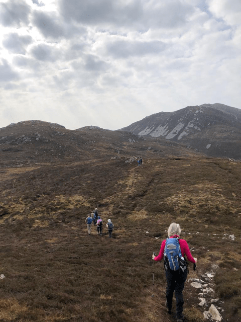
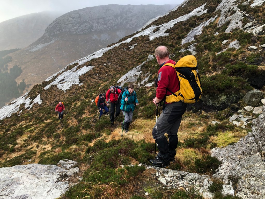
Muckish in January
29th January 2023
Getting up Muckish is one thing, but getting down again, is quite another (to quote R E Bowman’s book ‘The Ascent of Rumdoodle’).
And so it turned out, any concerns about ascending the Miners Track were soon dispelled when we reached the quarry (only a couple of hundred metres from the top). We were sheltered on the path and in the quarry, but could hear the wind thundering above on the plateau. We will go up, stick our heads over the top and return to the quarry for lunch? Good plan, but some were already saying that it was not a good idea to descent the Miners track. On the plateau, the wind had dropped temporarily to a mere breeze, so we went to the trig point, then the cross. The original plan was to cross the top and go down the west flank, but that would have exposed us to the strengthening gale for the rest of the day. Better to descend the nose, steep but sheltered. We didn’t take the best line, and the ground as we got lower gave way to greasy grass, (from the grippy heather of the upper
slopes). Tough going, with the weather deteriorating to driving drizzle, but everyone stuck at it, remained cheerful, and finished, miraculously getting back to the cars at the same time (by a variety of routes in NWMC style). Hardy bunch, these winter swimmers, plus Anne, Mairi, and Olga.
Trans Malin Bogtrot
6th November 2022
There were 9 club members plus 9 others (would have been more if I hadn’t had a senior moment leaving Malin Town and lost a carload) Apologies to those three ladies. Knocknamanagh was lovely in the bright breezy conditions, with views over Trawbreagy bay and Malin Head to the north, and the easterly bog trot not as bad as I had feared considering the recent deluge. Most made it up the Crua, and finished the involuntary extension. Well done all.
The Pyrenees
July 2022
During a van touring trip to the Pays Basque and the Pyrenees, Margaret and I managed to climb two of the more iconic eastern peaks in the Arriege. Pic Carlit, (which was very steep and very hot, and busy at the top, from those who had ascended from the other side) and Pic D’Estats the most eastern of the 3000m summits, which required an overnight in a hut. Montcalm its twin peak is a ‘must do’ when you are up there. I omitted to mention that we did a very little bit of the Cathar Trail, as recommended by Dennis, including their last stronghold at Montsegur.
Alan Tees
Aghla, Fintown
8th May 2022

A small group this week again, only six in total. Two opted for a low level walk, four took the usual route. A steep climb up from Páirc Achla (this time we veered toward the gully hoping that the ascent might be easier – it wasn’t!) reaching the summit of Aghla (593m) at 1:15p.m. where we had lunch. We were startled by a grouse as we approached the peak and discovered a nest with nine eggs, hidden in the heather. Our descent brought us past the secret waterfall. We joined the track from Loch Muc below An Cró Cam and met up with the two club members who were on the low level walk. The sun was shining so we found a sheltered spot and stopped for afternoon tea. We returned along the track to An Bheathaidh Mhór and the parked cars. We finished the walk at 4:00p.m.
A three and a half hour walk (8km), excluding stops.
Aghla Beg
1st May 2022
Only six walkers today. We parked at the roadside near Errigal carpark. The carpark is closed due to building work on the path to the summit. Work to be complete by October.
We walked up the R251 for about 1.5km to the track leading to Altan Lough. The hill tops were mist covered so decided to remain low until the mist had cleared. We turned east off the track, our destination two derelict farm houses, the unnamed stream emptying into Altan was impassable due to the previous days rain, it entailed a 1km trek up stream to find a save crossing. We had our lunch at the farm dwellings. The mist seemed to be clearing so finding a firebreak through the forestry headed up to Ardloughnabrackbaddy hill 603m. The hill unfortunately was still mist covered so the views were limited. We crossed over to Aghla Beg 564m still in mist and had to navigate our return which skirted Nabrackbaddy Lough, Lough Feeane and Aghla More down to Lough Altan and walked the beach at the head of the lough. The Altan Farm building is slowly falling apart with large cracks in the gable end and above window openings. We followed the track back to the road and the cars, a seven-hour walk. A cuckoo was heard and seen, a fox in the distance and a badger’s sett.
Slieve Tooey from Maghera Strand
24th April 2022
Eleven club members attended, although, in typical North West fashion, not all did the same walk. Two members did a low level walk exploring the beach and the small islands which were accessible at low tide. Three others stayed with the main group until reaching the summit of Meenachurrin (511m) and then headed south-east to reach the main road. This group returned by road, to the car park at Maghera, having completed a three and a half hour walk. The remainder of the group continued on to climb Slieve Tooey (472m) and then dropped steeply down the east side of the mountain to reach Lough Croaghballaghdown in time for the afternoon tea break. From there it was a short climb up again to reach Lough Acruppan. The group descended to Maghera by the easiest and shortest route, which involved following the water pipe down from the lake. We arrived back at the car park at 5:30p.m. making it a six hour walk in total. The views, throughout the day, were spectacular. Arranmore and Owey Island were clearly visible in the distance, with Loughros Point, Ballinreavy Strand and Maghera Strand nearer to hand. We finished the day with a coffee at the service station, outside Ardara, where we had car pooled earlier.
Slieve Sneacht and Slieve Sneacht Beg, Inishowen
3rd April 2022
Twelve from NWMC ascended ridge between Slieve Sneacht Beg and Slieve Sneacht from the middle track at the Slieve Sneacht Pilgrimage sign. Most regrouped on Slieve Sneacht Beg before ascending to trig point on Slieve Sneacht. We were accompanied by local charity walkers. We climbed into the round shelter for lunch. Weather sunny and cold affording distant views. From top we dropped down and ascended to cairn on Slieve Main before descending to a sheep track. We headed towards forest edge – thus avoiding the steep banks of two rivers before emerging out on track near cars – a leisurely 5 hours walk in total. Two snipe were spotted during the walk.
Some of the group stopped for tea, in Buncrana, on the way home.
Butler’s Glen, Inishowen
27th March 2022
There were 12 walkers today in bright warm sunshine. Jackets and top layers were soon removed. It was a gentle walk up the Glen on the track. Leaving the track at the col we found a nice place for lunch overlooking Lenan Beach. The views to the S.W. were of the Urris Hills, to the west Fanad and Fanad light house. The sea perfectly calm. While sitting there we saw an eagle flying over Lenan.
We returned via the Slievekeeragh ridge, back to the track and the carpark at Butler’s Bridge. A 4-hour walk. Noted was the very dry condition of the peat, after being so wet in February. Very little wildlife seen apart from a few ravens and many pairs of meadow pipits.
We had coffee and ice cream at the café beside the carpark.
Knockalla
20th March 2022
A dry but blustery day. On the exposed ridge the east wind quite keen. There were 9 walkers today. Parking at the gravel pit near Kerrykeel we proceeded up a muddy track to the S.W. end of the ridge that overlooks Kerrykeel. There are very fine views from Knockalla, some of the best in Donegal. Your eye is drawn to the water. To the south, west and north is Mulroy Bay. Mulroy Bay is an enclosed inlet of the sea about 14km long. The entrance to the bay lies between Melmore Head and Ballyhooriskey Point, the channel is quite narrow in parts and is some 10 km long. Very strong currents are evident during the flow and ebb of the tide. The channel was once served with a ferry but now is crossed by the Harry Blaney bridge near Ferry Point.
The views in the distance were obscured by haze but Milford town clearly visible to the south, Kerrykeel below, to the west Muckish, Errigal and Horn Head. To the north Fanad Head and Murren Hill with the ocean beyond. To the N.E. Dunaff Head and Dunree Fort and below Portsalon and Ballymastocker Bay. To the S.E. and south stretching inland is Lough Swilly.
The walk proceeded along the ridge, 363m, lunching beside Knockalla Loughs. We descended to the Lurganbrack track and returned along the west side at the foot of the cliffs.
We were often walking on quad tracks. This area has become a playground for quad riders. Deep cuts have been made through the peat, and in places the bed rock exposed. In other areas it seems the peat has been deliberately churned to give the riders a more challenging experience. The environmental damage is extensive. Our political leaders and law enforcers seem to do little to combat this vandalism despite MI continually highlighting the problem. It seems highland areas are out of sight and therefore out of mind.
We returned to the cars by 4pm a 4.5hr walk. 10 displaying ravens seen and a few meadow pipits.
Dunlewey and Altan Farm
13th March 2022
The weather was deemed to be too bad for the Poisoned Glen, heavy rain and more importantly too windy for the exposed cliffs overlooking the Glen.
Alternative walks were hastily organised. Four members decided to walk the forest track from the causeway dividing Dunlewey Lough and Lough Nacung to the junction with the N56 at Gweedore and return. The conifer trees to the south afforded good shelter. Views to the north were of the Loughs, An Chuirt Hotel and the wind turbines on Tievealehid Hlls. To the N.E. towering over the whole area Errigal. To the south Crocknafarragh and Grogan More, though shrouded with mist and rain.
This was a pleasant easy walk of about 13km.
Altan Farm Walk:
The Poisoned Glen- a poison chalice.
It’s a tough walk, but the weather forecast was tougher, so it was an easy decision to go somewhere else. Some arrived with mind made up to walk around Lough Nacung, but most made the best of a plan B, which was to seek the shelter of the leeward side of Macoght. It was a mixed party of NWMC members and Colmcille Climbers who were blown up the road to the turn off into Altan Farm. The farm was sheltered, and Seamus gave us a synopsis of the history of the structure, before we turned up into the gorge, back towards the nordwand of Macoght. After lunch, Alan said he knew of a great gully which would lead to the top, but couldn’t remember where it was. Martin Boner said he knew exactly where it was, so we followed him, except Richard- who knew not to. A greasy steep slope led to the gully. “I don’t remember this” said Alan. It was a different gully, but not to worry, we got to the top, despite some quiet swearing by Livinia (and not so quiet by Damien) about the greasy surface. Back in the teeth of the gale, we descended by the Errigal Path to the car park and thence to Roarty’s for coffee. Made the best of the conditions, methinks.
Barnes Mor Gap to Blackburn Bridge
6th March 2022
Six members were on this low-level linear walk in bright warm sunshine. However, in shaded areas ice and frost persisted well into the afternoon.
We parked at Barnes Mor Gap crossed the N15 road to a forestry track beside the Lowerymore River. The track follows a roughly North-N.E. direction, passing between dense pine and spruce forestry in one section. We passed Lough Sallagh on the right and entered a more open landscape with fine views of Garranbane Hill to the North and Meencargagh to the S.E. We passed several old farm dwellings (wall steads) slowly being swallowed by encroaching bushes and trees. We marvelled at the size of some of the lintel stones used over door ways and in the chimney breasts.
Our path led us ever East and S.E. through recently cut forestry, the pine resin smell delightful. We measured one large log at about 800mm diameter with 38 rings – 38 years old, one ring being about 12 mm. An indication of the rapid growth of coniferous trees in our mild wet climate.
We arrived at Blackburn Bridge and previously parked car at 3.45, a 4.25hour leisurely walk.
Two buzzards seen.
Drumnacraig, Fanad
27th February 2022
The Fanad Peninsula protrudes into the Atlantic in a northerly direction. Is bounded to the east by Lough Swilly and to the west by Mulroy Bay, the most northerly point crowned by Fanad Light House.
Our walk to Drumnacraig was via road, track and hill and the return via track, road, beach, low coastal cliffs and road back to the start. An easy walk with the highest elevation of just 130m. We started at the new carpark adjacent to the renown Portsalon Golfclub. This course runs parallel to the internationally known Ballymastocker Bay and strand.
The first part was on the road climbing Croaghross hill leading to a track to Drumnacraig Hill. Our route was along the top of a near vertical escarpment some 100m high. We passed Lough Doira and Lough Goragh. Near here is a bog with protruding Scots Pine stumps, bog pine. It is likely there was turf cutting lowering the bog exposing the stumps. These trees are likely to be from 3000 to 5000 years old, the trees dying and falling as the climate became wetter and the peat began to form.
The views from this high point are spectacular. To the west Murran Hill, to the north the Atlantic Ocean, N.E. Dunaff Head and Malin Head in the hazy distance. Due east are the Urris Hills and south Inch Island in Lough Swilly.
We descended to a track and road and on to Drumnacraig Strand. Though the sea did not look rough we had to beat a hasty retreat at one stage as the waves swirled in across the sands. You can never be too careful. We observed two brave people taking a dip. From the strand we went to Leel Point then Doaghcrabbin hill to the road and back to the cars by 3.30 a 4.5hour walk. The east side of Fanad is protected from the prevailing winds allowing mature trees to thrive along the road side.
We saw four buzzards and several snipe.
Mamore Hill and Raghtin More
20th February 2022
Eleven walkers, including one newcomer, ventured out, in the wind and the hail, last Sunday. Starting from the car park at Urrismenagh, the group followed the track for a short distance, before turning off and climbing steeply to reach the top of Mamore Hill (423m). From there we descended gradually along the ridge until we reached the track again. At this point some of the group decided to walk on the track while others continued on, to climb Crockmain (460m) and Raghtin More (502m). The strong wind made climbing difficult and there was the added hazard of pockets of snow which were up to half a meter deep in places. On reaching the summit it was suggested to the newcomer that he take a look at the view, as he had never been there before, but, unfortunately, it was too wild to leave the shelter of the cairn and walk along the top. He was advised to come back on a summer’s day!
We retraced our steps, staying on the relatively sheltered eastern side of the hill, until we reached the track. Once on the track we had to walk due west, directly into the wind and a cutting shower of hailstones, for about 1.5km, until we were back at the cars. A three hour walk in total but, given the unfavourable weather conditions, we felt as if we had done much more.
Those of us who were returning via Buncrana, stopped off at the Fisherman’s Wharf for coffee and scones while others, who were travelling via Carndonagh, stopped at Claire’s.
Thanks to Richard for leading and to Cyril for the photographs.
Assaranca Waterfall and St. Conal’s Way
13th February 2022
Only seven walkers met for the walk in Glengesh. It was decided that, as it was raining and the mist was low on the hills, it would be better to go to Assaranca Waterfall and take the nearby track marked St. Conal’s Way. After admiring the waterfall, we walked up the track to Mínte Seisce and then followed the road leading to Loch na Luchraman. We stopped for lunch by the ruins of an old cottage, near the disused stone works. After lunch we left the road, crossing a low boggy hill, Maum (325m), before eventually rejoining the main road at the head of the glen. We continued on the road back down to Maghera and on to Assaranca.
A leisurely three hour walk with very little climbing and with fine views of Maghera Strand.
We stopped in the Nesbitt Arms for the usual coffee and scones.
Trá na Rosann to Melmore Head
30th January 2022
There were 13 walkers in total, including two newcomers. We set out across Trá na Rosann and climbed the hill overlooking the beach, enjoying the fine views as we went. We continued until we reached the 2nd World War lookout post, overlooking the Murder Hole beach (Báigh Uachtar), by which time the wind had risen and the waves were crashing on the beach below. We didn’t delay long at the lookout post as we feared that the incoming tide would prevent us accessing the second beach. A quick climb down to the beach, a few minutes to show our newcomers the inside of the cave, a hop, skip and a run to avoid getting our boots wet and then we were able to relax, knowing that we had beaten the tide and didn’t have to take the long route back over the hill. We settled down to enjoy an early lunch, high up on the beach away from the rapidly incoming tide. The weather began to deteriorate in the afternoon, with passing showers of rain. By the time we had completed our walk around Melmore Head the rain had set in. The walk leader’s car had been parked near Melmore before the walk began, some of the group took a lift back to the car park while others walked the remaining 3km. All were back at their cars by 3:30p.m., a four hour walk in total.
Note: There were access problems in two areas. Two of the group decided to walk back from the Murder Hole beach, across farmland, and found that the land has been completely fenced, they had great difficulty getting out onto the road. There is no longer access from the road at Melmore to the Murder Hole beach, or vice versa. From Melmore Head others returned, via the caravan park, to find that the perimeter of the caravan park has been completely fenced and the gate to Tranafaighaboy beach is locked. The only exit from the caravan park is by the main entrance gate which, fortunately for us, was unlocked.
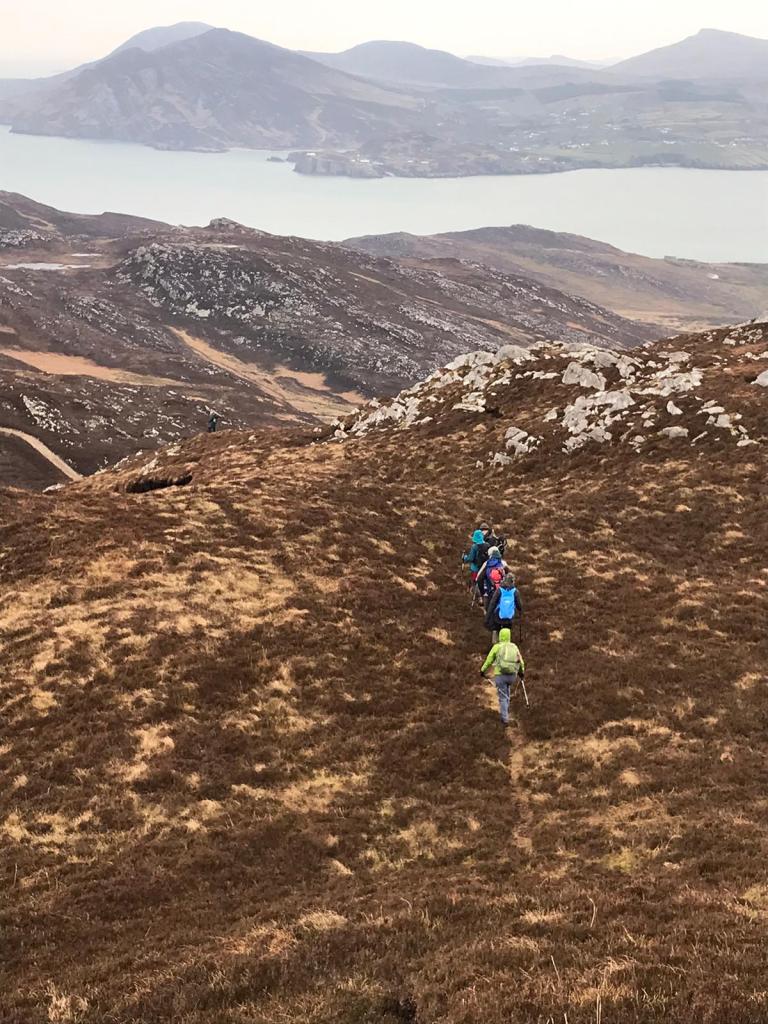
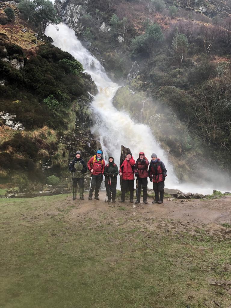
Bluestacks: Grey Mare’s Tail Waterfall and Lavagh Beg
23rd January 2022

There were 12 walkers today. After meeting at the Mill Park Hotel, Donegal Town, we travelled in convoy to the entrance of Sruell Gap, a valley that leads into the heart of the Blue Stack Mountains. We walked up the valley on a muddy farmer’s track, to the base of the Grey Mare’s Tail. These falls are some 100m high and come down a series of impressive cascades. The route was up a very steep grassy slope on the right-hand side. The falls are fed by an unnamed stream issuing from Lough Asgarha. There are five lakes here contained in the hollow surrounded by Lavagh More, Lavagh Beg and Binnasrull mountains.
After lunching beside the lough, we went up Lavagh Beg, 650m. On top it was very windy with a high windchill factor so did not linger. Views were obscured by low cloud. We took compass bearings for our route back which was in a south westerly direction. We arrived back at the cars at 4.30 a 5hour walk.
One club member extended the walk to include Lavagh More and Silver Hill as well.
The lakes attract migrant birds such as geese and whopper swans but none seen today. Grouse droppings were seen in two locations.
Connemara Trip
January 2022
A mixed group consisting of NWMC members, Colmcille Climbers and Blaney Ramblers met up at Yeat’s Tavern, Sligo – some to scramble about in King’s Gully, others to walk up Pinnacle Gully, and a small select group, not fancying the steepness of the slope, drove on to walk the Sligo Way, around Lough Gill.
Our base was Letterfrack, on the north side of the Twelve Bens, and across the way from the Maumturk Mountains. We stayed at the very comfortable Connemara National Park hostel, close to the centre of the village. And two pubs.
Saturday did not dawn very promisingly. Some, sensibly, chose to walk down tracks and around lakes, while others decided to tackle the eastern side of the GlenCoaghan horseshoe. Starting near the shore of Lough Inagh our route took us up the slopes of Bencorrbeg, along to Bencorr, then finishing on Derryclare. A reasonably challenging day, given the weather. One of the group ran a similar route but he started at Knockbrack, going over Benbrack, Muckanaught, Benbaum and Bencolladuff before even arriving at Bencorr, well before us.
On Sunday, everyone went up Diamond Hill. You never get tired of Diamond Hill – it’s a little gem. Margaret Tees.
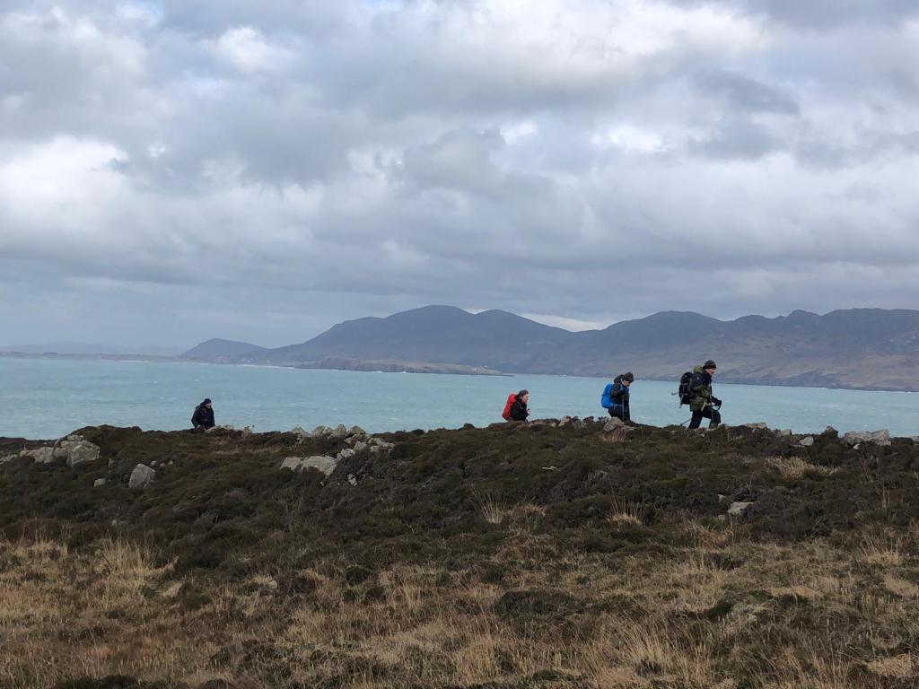
Bloody Foreland, hill and coast
16th January 2022
There was a big turnout today, 33 people in perfect walking weather. The walk coordinator Seamus managed to encourage 16 new people to try out with NWMC along with 17 members. It was dry, not cold but with a steady breeze. Good visibility. We parked at the viewing point overlooking the ocean with Tory Island directly North.
We proceeded at a slow steady pace, unaware of the fitness levels of some of the new people. We went up the west facing slope to the top of Bloody Foreland hill 314m. The grade is quite easy with no steep sections. From the top the view north is of the Atlantic Ocean with fine rolling waves crashing onto the rocks. Tory Island in the middle distance. To the N.E. lies Inishbofin and in the far distance is Horn Head. To the S.E. is Muckish and the Aglas, South is Errigal and Dooish while to the S.W. along the coast is Inishsirrer, Gola, Cruit, and Aranmore.
From here we headed down and crossed the R257 road to a bog track leading to the sea edge and cliffs. The cliffs are low and comprised of loose boulder clay (glacial deposits) overlaying granite. The boulder clay has been eroded exposing in places a pavement of granite. Huge granite boulders have been thrown up by the Atlantic waves and lie at the base of the cliffs. The waves crashing today were mesmerizing with everyone impressed with the power of the spectacle.
We continued westwards along the coast to Rinardalliff Point and the promontory fort. Seamus gave us a short history of the feature. Continuing we joined a way marked path passed farm buildings to a tarred lane bringing us to the cars. An easy yet very rewarding walk of 4.5hours. Two grouse, a kestrel and a hare seen.
We rounded the day with a visit to Roarty’s café in Dunlewy for coffee and hot chocolate.
Brown’s Hill, The Blue Stacks
9th January 2022
There were eleven out today in a cold blustery S.W. wind. On the summits it was blowing strongly giving a high wind chill effect. In the distance snow showers whisked by but missed us. There were small patches of snow and the lakes were partially frozen over.
We commenced the walk from the Barnesmore Gap carpark up the forestry track northwards and turned off towards Brown’s Hill 498m after about 1.5 km, a stiff climb of about 250m to the top. The view westwards encompass virtually the entire Blue Stack range but hazy and obscured by the snow showers. We crossed over to Croaghnageer, three peaks of 521m, 571m and 546m respectively. Views to the S.W. of Lough Eske in the valley below.
We returned via Barnes Lough and the same forestry track. A walk of 4.25hrs.
Two woodcock seen.
Urris Hills from Lenan
2nd January 2022
This was a substitute walk as access to the scheduled walk to Mouldy hill was in question.
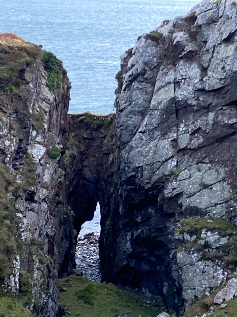
There were 15 walkers, and, delighted to say, the return of some past members. We commenced from the parking area near Lenan beach following the bog road south westwards for about 1km. We then descended to the edge of the sea, skirting the cliff edges marvelling at the rock formations that have been sculpted by the sea. There are sea arches, bridges and undercuts. The sea has tunnelled inland in places some 50-100m eroding the loose rock to form large steep sided holes. There is also a remarkable gorge like feature, with vertical sides some 15-20m deep about 3m wide with a tunnel out to the shoreline.
From here we climbed up to Lough Fad and joined the Urris Hills Loop. A way marked path. We returned via Crunlough lake following the track back to the start. A 3.5-4 hr walk in generally good weather. One heavy shower produced a spectacular rainbow over the sea.
Glenveagh
19th December 2021
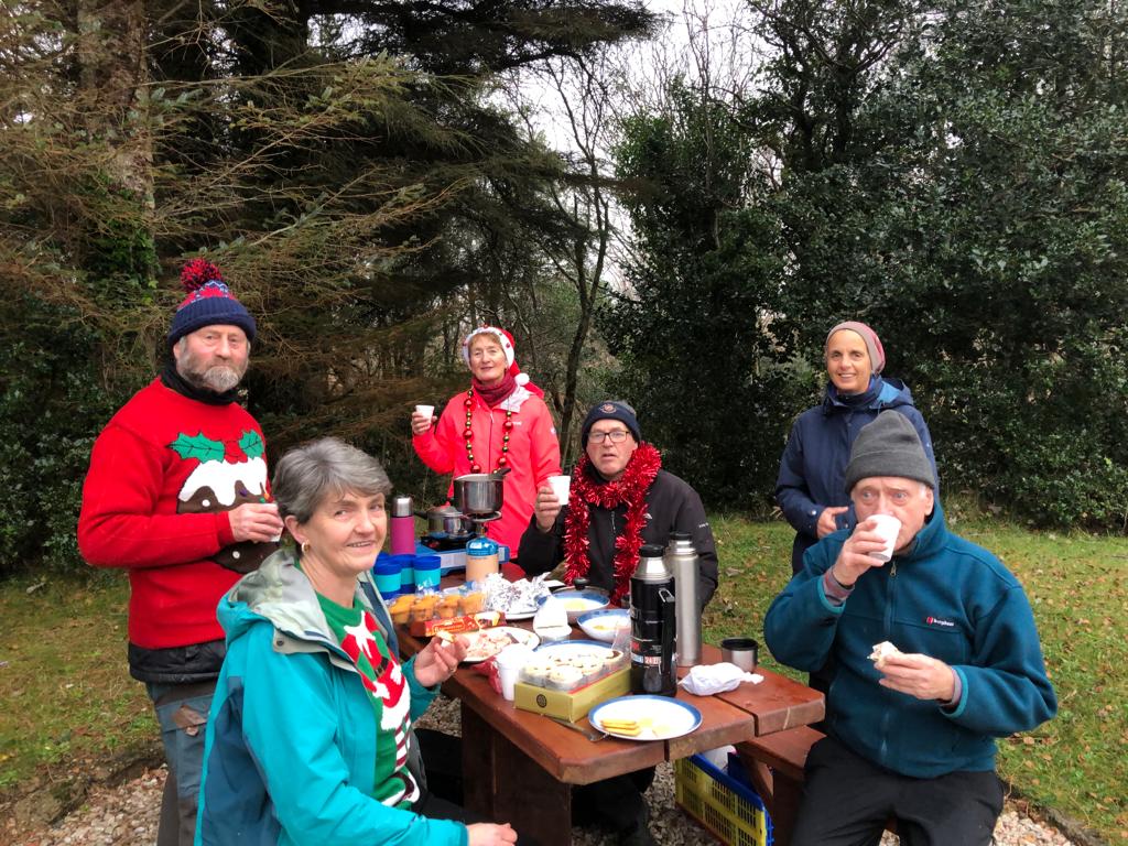
Due to the Covid restrictions curtailing social gatherings through the year we decided on a short walk followed by a picnic on the last Sunday before Christmas.
Glenveagh was our destination. The walk, or should I say stroll, took us to the viewing point overlooking the castle. From there to the castle yard for coffee. We returned to the carpark via the castle gardens, still beautiful despite being mid-winter. We commented on the professionalism of the design giving the attractive layered structure. We noticed some of the plots in the walled garden have been given over to grass, we speculated this was due to lack of personnel, Covid related.
Our picnic proceeded, there are a number of tables around the carpark providing the perfect picnic spot. There was a range of goodies and we all ate far too much. It was topped off with a toast of mulled wine. There was a ‘best Christmas jumper’ competition won by long standing member Dennis G.
Thirteen members attended. The weather was perfect, dry and completely calm.
Lough Altan – Mackoght
21st November 2021

There were twelve walkers today. Setting out from Errigal carpark on a dry fresh day. The northerly wind encouraged us to walk briskly up the R251 road for 1.5 km to the track leading to Lough Altan. The track, now much eroded and boggy was built to serve Altan Farm. The Altan Farm building is a castle like structure, and is now derelict and dangerously crumbling. Built mid-1800s the history of the farm and construction are obscure. The building is at the south end of the Lough and from it there are fine views. To the west the steep vertical cliffs of Beaghy. To the north west the expanse of the Lough some 3.5km long and to the north east the steeply rising ground of Aghla More and today bathed in warm winter sunshine. Lough Altan now serves as a water source for Prockliss Fish farm (MOWI)
We had our lunch on the Lough’s shore, a sandy beach stretching the length of the south end. From there we went along the west side to a gully formed by a stream issuing from Lough Nabehy. The gully was tough going, steep with slippery rocks and too much water. We aborted the attempt at its traverse and climbed with some difficulty up the side. We had hoped to see unusual flora within the confines of the gully but none observed. The rest of the walk was very pleasant continuing to L. Nabehy and L. Nabrackbaddy on the north side of Mackoght. We noted an intrusion of basaltic type rock cutting through the quartzite of Mackoght, something to be investigated another day. Four members extended the walk and went up Mackoght from the north side, the rest continued to the col below Errigal and down to the cars by 4.15pm a 4.5-hour walk. We retired to Roarty’s café in Dunlewy for coffee.
Knockalla
14th November 2021

A dry, mild but misty day. The tops of the Knockalla ridge were mist covered with occasional breaks giving views of Mulroy Bay to the west and Lough Swilly to the east. The Knockalla ridge runs in an approximately N.E. / S.W. direction. We think the rock is quartzite and this geological structure extends to the Urris Hills in Inishowen. Lough Swilly divides the two having been carved through during the last glaciation.
There were twelve out today. We commenced the walk from the gravel pit near Kerrykeel at the south end. There is a wet muddy track leading onto the hills. Our route was N.E. along the crest. The views were mostly obscured during the morning. We had lunch beside the Knockalla Loughs. These loughs always appear very dark, evidence of the peaty water that feeds them. Half the party returned at this stage going down a bog track to Glenvar and to the cars via the road. The rest continued to the track that serves the Stations of the Cross at Lurganbrack but returning along the west side at the base of the ridge to the loughs and down as the others had done.
We saw a small flock of golden plover flying overhead and also two grouse. We see grouse quite regularly, a sign perhaps of increasing numbers. We looked in vain for the feral herd of goats that wander around the northern end of Knockalla. The mist cleared gradually during the afternoon so we had fine views of Mulroy Bay and the Narrows (spanned by the Harry Blaney bridge) to the north west.
The cars were gained by 4.15 a 4.5hour walk.
Adderwal Glen, Gubbin Hill (Doocharry – Fintown)
7th November 2021

The walk through Adderwal Glen is a popular outing and twelve members turned out. The weather as forecast was calm and dry with periods of warm sunshine.
We met in Fintown and car pooled (Covid mindful) to the start near Doocharry. There are no serious or difficult ascents on this walk, most is on a wet boggy track. The first part passes deciduous woodland. During early summer this is a good area to spot the rare holly blue butterfly. Further along there is a coniferous plantation. We passed over the Abroe River via a concrete bridge then passed Loughs Leck, Currin, Fad and Ahassan. We expected to see wild fowl here as this area is part of Meenachullion nature reserve, but we were disappointed. We did see mallard duck on Lough Namona. The rock here is granite, with outcrops appearing through the peat. There was a splash of colour, a gorse bush in full bloom, the yellow flowers striking against the dull winter palette.
We speculated this area was once quite wealthy, dotted along the track are derelict houses, and wall steads, all well built with several rooms and out houses. Two of the houses are still roofed with the contents left as if still in use. Even the field walls are substantial. We noted two well-built lime kilns.
Leaving the track, we headed up to Gubbin Hill at 271m, via the way marked path. The views from this high point to the north are Slieve Snaght, south Aglas and Scaigs and north west in the distance Aranmore Island. On the descent we saw three red deer and four grouse. Our path led us to the R250 road on the outskirts of Fintown, returning to the cars by 4.20pm a 4.5hour walk.
Urris Hills
31st October 2021
What was forecast to be a fairly wet day, turned out to be sunny, with little wind, and great views. We decided to walk over to the north side of Crummie’s Bay, from where some continued to follow the coast and others chose to take a line between the coast and the gradually rising main ridge, to the north-east. Scrambling over and around rocky outcrops we arrived just above the first (of two) lakes, a good place to stop for lunch. Having being joined by the other party, we continued steeply, up towards the main ridge and then on to the highest point at 417m.
From here we turned to follow the ridge path back to Dunree beach and the carpark.
Walking westwards on this ridge, on a bright sunny day, must be one of the best mountain views in the whole of Donegal.
Margaret Tees.
Aghla Scraigs (Fintown)
24th October 2021
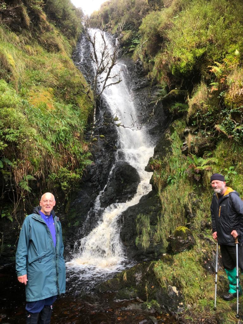
Eleven were on the walk today. Six ventured up Aghla Mountain, 593m, a very steep climb from the starting point by the GAA grounds. A dry day with a S.W. wind, gusting strongly at times clearing the mist to give fine views of Fintown and Lough Finn to the N.E. and the coast to the west. This group split, three continuing to Scraigs, 428m, a craggy mountain due south of Fintown, returning via the track. The other three came down between Aghla and Scaigs visited the waterfall then returned to the cars.
The other five took the track parallel to Lough Finn venturing onto the hill at the base of Aghla, visited the waterfall, a secret place! (The vertical falls are some 15m high on an unnamed stream) from there to the crags overlooking Lough Muck, a fine lake and drinking water source. This group also returned via the track.
On the walk a small bird of prey was seen, falcon like, so probably a merlin. Also, a covey of about 10 grouse. This is the second large covey seen this year, an encouraging sign that numbers are increasing.
On the way to the start of the walk a white tailed eagle was spotted flying over Fintown, there was some excitement trying to get a photo but it was too far away.
A good day’s walking of 3.5hours and 4.5 hours with very little rain and the wind on our backs as we walked from Aghla towards Scraigs.
Farewell Lunch
22nd October 2021
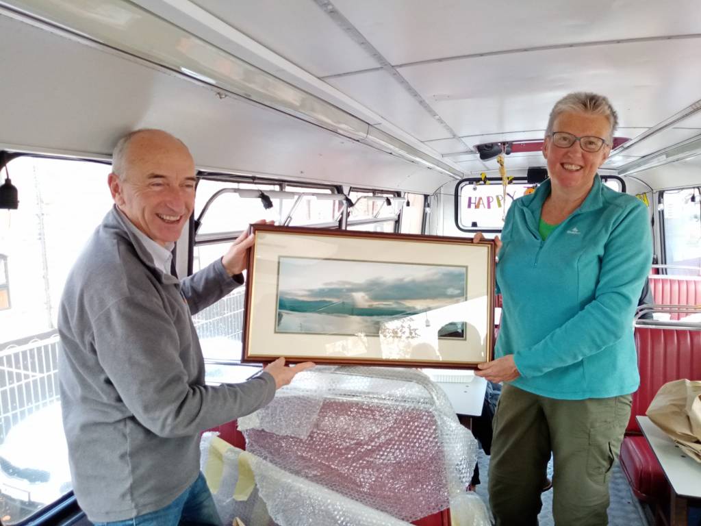
There was a sad farewell to stalwart members Helen and Geoff who are retiring to Wales, who have been with the club for more than twenty years. We had a lovely lunch in the double decker bus Pyke ‘N’ Pommes situated on the quay in Derry. Helen and Geoff were presented with a stunning framed photo of Five Finger Strand, Inishowen. Photographer, our own Tony K. We then adjourned to The Cottage café for coffee and cake.
Geoff is a very experienced climber and Helen, a past club chairperson, is second to none when tramping across the hills. We will miss them and wish them the best of luck and happy life in their new home.
Margaret & Alan’s recent trip to Scotland (October 2021)
Our Trip to Scotland
A good way to start? On our first day we climbed Ben Nevis (1,344m, just to remind you) with our grandson, who really should have been at school . . .
While taking it easy the next day, we went to support some of our other offspring who were running in the Glencoe Marathon (this was their version of a warm-up for the mountains).
Before moving on further up the country, we chose to do what we thought was a reasonable ridge walk to an isolated Corbet behind Beinn a’ Bheithir, but discovered the approach was not cyclable, the hill sides densely forested and the multiple intervening tops extremely tedious. The day became so wet, there was no possibility of a photo at the top . . .
After a speedy escape to the more northern realms of Torridan, and getting better weather, we climbed a gem of a hill called Sgurr Dubh, facing the towering ramparts of Beinn Eighe.
We had based ourselves in Gairloch, some way out from the mountains we wanted to climb, but such a lovely location. The campsite was close to the pier so morning dipping was a must; the Mountain Coffee café/bookshop was close by and its doors were always open; the supermarket stocked everything even gluten free products; there is a fragrant Buddhist emporium and a master butcher dealing in venison, 5star haggis, and various other Highland gastric delights.
We had bikes and kayaks with us, and we took rest days when it rained, which was fairly often. Leaving Inverness, (after visiting relatives) our next venture was to cycle 16k through Glen Mor to climb the remote mountain Carn Ban. We parked at Calvie Lodge (near the infamous Allendale Estate where wild bears, wolves and boars be roaming), and set off the first afternoon up the nearby Cam Chuinneag, courtesy of a stalkers path all the way to the top. Back to business early the following morning, cycling the reasonably good estate track in good time, dodging the potholes and highland cattle with aplomb. We left the bikes at the top of the last big downhill and turned our sights to the back of this massive hill, nothing craggy about it but there was a lot of it. We arrived at the top, eventually, as you do. To be rewarded with tremendous views, all round, (it wasn’t raining). Next to us rose the fabulous profile of Seana Braigh considered one of the most beautiful and remote of all the Munros. Having failed to get out to Skye due to Ferry timetable disruptions (several boats being out of service), our last big day was back down the country again at Glenfinnan. There are two Corbetts, close together here, which is quite unusual. Climbing in the drizzle again, having to navigate awkward crags, and endless ‘false tops’ we eventually made it to the top of Beinn Odhar Beag (Beinn Odhar Mhor which comes first, is not unfortunately the highest) and the measly summit cairn which marks it. I won’t say anything about the big drop and then rise to the other Corbett, suffice it to say it is called Beinn Mhic Cedidh. Due to railway tracks and puffing trains below, our descent from there took us part-way down the glen, then up again to cross a col on the main ridge, to complete the circuit and arrive exhausted at our car park. And the end of our trip!
Alternative to planned walk: Head of the glen to Glenveagh Castle
17th October 2021
Unfortunately, there was thick mist and heavy rain with no appearance of clearing. Though some members wanted to brave the elements it was decided to abandon the walk and drive the few kilometres to the head of Glenveagh glen and walk to the castle.
The lower we went down the valley so the weather improved with even a few moments of sunshine. The glen affords spectacular views and we were not disappointed. The autumn colours of the leaves and heather, the castle looming out of the mist above the trees was magical and mystical.
We had coffee and lunch in the castle courtyard followed by a quick walk around the walled garden. We returned by the same way. The highlight being the sighting of an eagle, high up, gliding north to south to disappear into the mist. No deer sighted.
We noticed the higher areas were still misted and it was still raining so perhaps we made the correct decision.
Walk time about 4.5hours
Irish Peaks Book wins Banff Mountain Book Award
21st October 2021
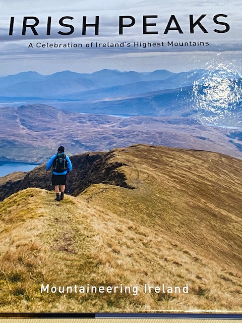
Congratulations to long standing members of NWMC Margaret and Alan Tees as team leaders in the compilation and publication of Irish Peaks: A Celebration of Ireland’s Highest Mountains, published by Mountaineering Ireland. This publication has won the 2021 Banff Mountain Book Competition, guide book section. ‘’A wonderful showcase of the rugged beauty of the island of Ireland’s upland landscape, Irish Peaks made me want to head for those hills’’ Heather Dawe, 2021 book competition jury.
https://www.banffcentre.ca/2021-banff-mountain-book-competition-awards
The book describes 101 of the highest peaks in Ireland. The route guides are aided by fabulous photos. It can be used as a first port of call if attempting any of the walks or as an interesting coffee table book to browse at leisure.
Well done again Alan and Margaret.
The book can be purchased online and direct from selected retailers, for more information visit https://www.mountaineering.ie/irishpeaksbook/
Walk from Portballintrae to Dunseverick and return
Sunday October 3rd 2021
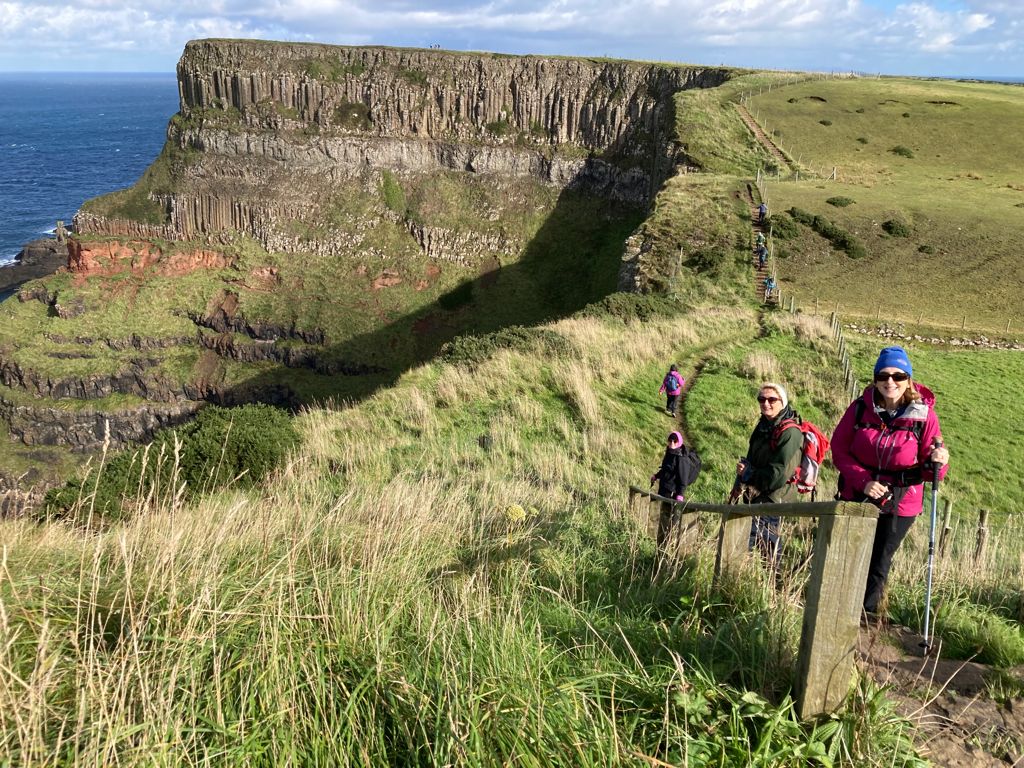
Though a long drive the Causeway Coast is a favourite for the club. Twelve members met at Portballintrae carpark. The forecast was for thundery showers, they duly swept through all day on a brisk and sometimes very strong N.W. wind but luckily missing us.
The walk commenced along Bushfoot Strand, the sea crashing on to the sandy beach, the sea was coloured by the peat laden water from the Bush River. From the beach we made our way up to Runkerry Point and on to the Giants Causeway. (the Causeway is one of the top attractions in N.I. and can be mobbed at times) The black basaltic hexagonal columns forming the causeway and the vertical cliffs are impressive. They have spectacular names such as the Giants Chair, The Organ, Hawk’s Hollow and The Amphitheatre.
From the cliff top through the sea haze Malin and the Inishowen Peninsula, Co Donegal could be seen to the west. To the north Islay, Scotland and to the east Rathlin Island and the spectacular shear cliff of Fairhead. Further to the east lay Kintyre. Out to sea gannets were giving their aerial displays, effortlessly gliding through the wind then suddenly diving for fish. Jackdaws were our companions along the cliff tops.
The path is of gravel with stone steps on the steep inclines, well maintained by the National Trust. The path continues around Benbane Head, Bengore Head and Contham Head down to Dunsverick. Some members took the bus (departs hourly) back to Portballintrae. The rest returned via the path arriving at the cars at 4.15. A 4.5hr walk.
Coastal walk: Trá na Rosann beach to Melmore
Sunday 26th September 2021 We try to have a mix of walks hill, mountain and coastal. Coastal walks are generally easier without much climbing. These are ideal for people who want to see if walking with the NWMC is what they want. Without doubt Donegal’s coast is stunning with long golden beaches, rugged rocky outcrops,…
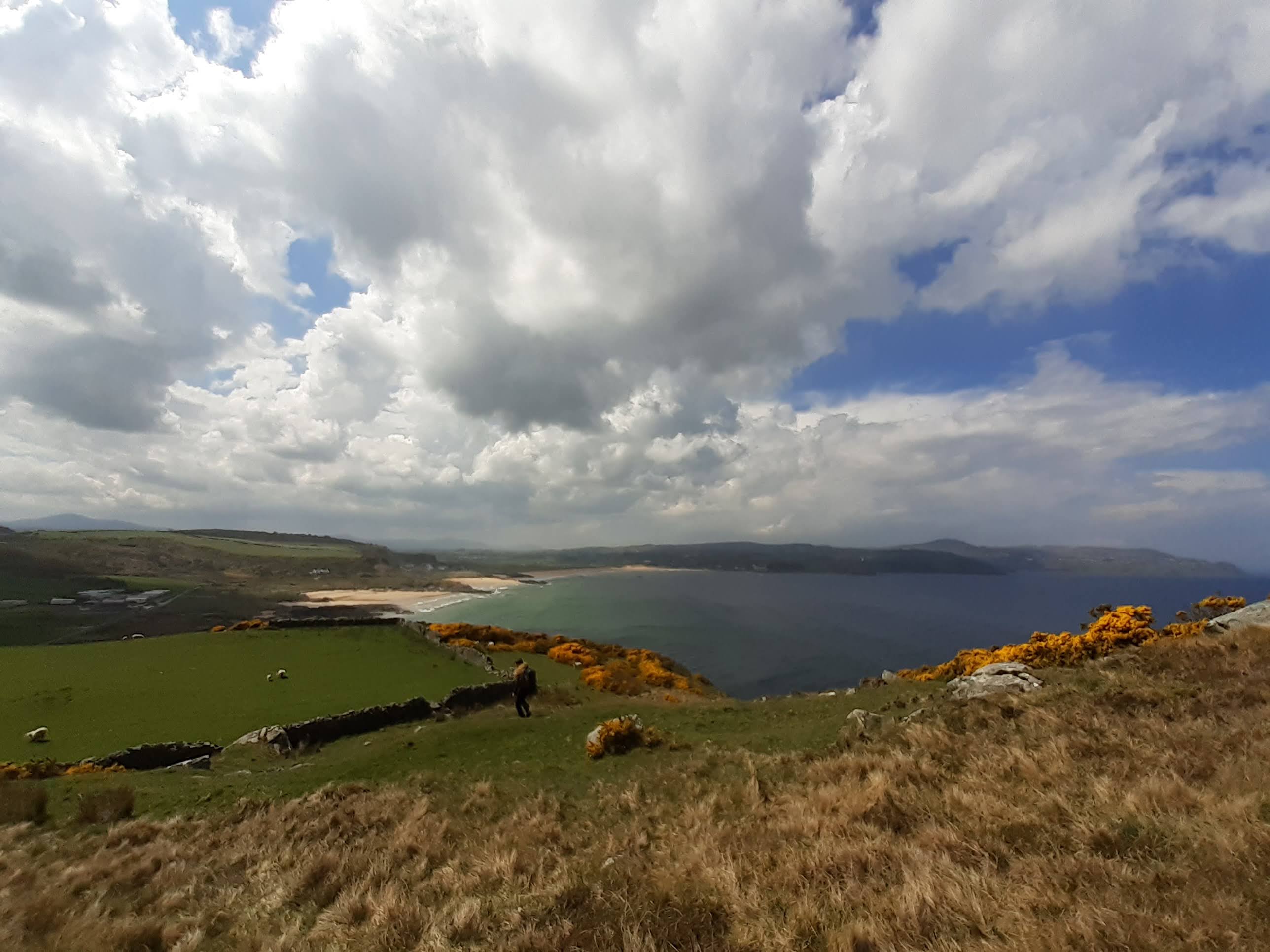
Walk to the Lough Belshade and Eglish area of the Blue Stack Mountains 19th September 2021
We parked overlooking Lough Eske on the track that circuits Banagher Hill. The forecast was good but heavy showers commenced shortly after leaving the cars. As is usual for the NWMC the group split with two members doing a shorter walk to Banagher hill. The main party of seven walked eastwards towards Lough Belshade. On…
Training
Seamus Doohan is now the NWMC VTO.
Walk on Sun Sept 25th 2016
We had a lovely walk in the hills coordinated by Dennis Golden, starting near the waterfall at Maghery outside Ardara and finishing a few kilometres down the road from the waterfall – a good hill-walk after the NWMC AGM in Highlands Hotel Glenties. Report – James Finnegan
Leave No Trace
The Seven Principles of Leave No Trace are: Plan Ahead and Prepare Be Considerate of Others Respect Farm Animals and Wildlife Travel and Camp on Durable Ground Leave What You Find Dispose of Waste Properly Minimise the Effects of Fire For more information see the website: www.leavenotraceireland.org
Walk on Sun Mar 26th 2017
Bluestacks Horseshoe – Glascarn Hill to Lavagh More – very sunny, blue skies and streaks of snow on some tops – great day. Thirteen walkers – three eventually finishing over Lavagh More – Helen O, Livinia F, and James F – walk led by James F.
Walk on Sun Nov 13th 2016
Walk in the Aghlas was led by James Finnegan who disappeared after Crocknalaragagh. All fifteen walkers made it back safely on a windy day and in daylight. James is the only person who did Aghla More on the day but there was no prize given for that. Some say he is lucky to be alive.
Follow My Blog
Get new content delivered directly to your inbox.
